File:CWD US Map.jpg
From MicrobeWiki, the student-edited microbiology resource
Size of this preview: 800 × 539 pixels. Other resolution: 920 × 620 pixels.
Original file (920 × 620 pixels, file size: 101 KB, MIME type: image/jpeg)
Summary
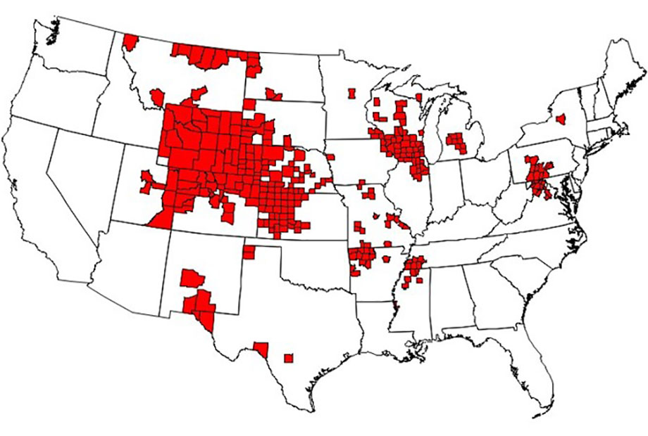
As of January 2020, there were 299 counties in 24 states with reported CWD in free-ranging cervids. This map is based on the best-available information from multiple sources, including state wildlife agencies and the United States Geological Survey (USGS).
File history
Click on a date/time to view the file as it appeared at that time.
| Date/Time | Thumbnail | Dimensions | User | Comment | |
|---|---|---|---|---|---|
| current | 00:59, 23 April 2020 | | 920 × 620 (101 KB) | Stafford1 (talk | contribs) | As of January 2020, there were 299 counties in 24 states with reported CWD in free-ranging cervids. This map is based on the best-available information from multiple sources, including state wildlife agencies and the United States Geological Survey (US... |
You cannot overwrite this file.
File usage
The following page uses this file:
