Uploads by Bariley
From MicrobeWiki, the student-edited microbiology resource
This special page shows all uploaded files.
| Date | Name | Thumbnail | Size | Description | Versions |
|---|---|---|---|---|---|
| 18:58, 2 September 2008 | CCH proc.jpg (file) |  |
37 KB | Reproduced/modified by permission of American Geophysical Union. Stibal, M., Tranter, M., Laboratory investigation of inorganic carbon uptake by cryoconite debris from Werenskioldbreen, Svalbard., Journal of Geophysical Research, Vol. 112, G04S33, Pg 1- | 1 |
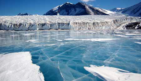
| 21:04, 28 August 2008 | GLACIERSIDE.jpg (file) |  |
89 KB | The Canada Glacier extends into the Taylor Valley toward Lake Hoare. Photograph by: Emily Stone National Science Foundation Date Taken: January 16, 2006 | 6 |
| 20:27, 28 August 2008 | Mars.jpg (file) |  |
16 KB | Mars with polar ice caps. http://grin.hq.nasa.gov/ National Aeronautics and Space Administration. | 2 |
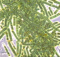
| 20:22, 28 August 2008 | Lyngb3.jpg (file) |  |
46 KB | Filamentous Cyanobacteria, without heterocysts © 1997, Microbial Diversity | 6 |
| 20:10, 28 August 2008 | LAKEFRYXELL.JPG (file) |  |
52 KB | Photograph by: Joe Mastroianni National Science Foundation Date Taken: December 10, 2002 The blue ice covering Lake Fryxell, in southern Victoria Land, comes from glacial meltwater from the Canada Glacier and other smaller glaciers. The freshwater stays | 2 |
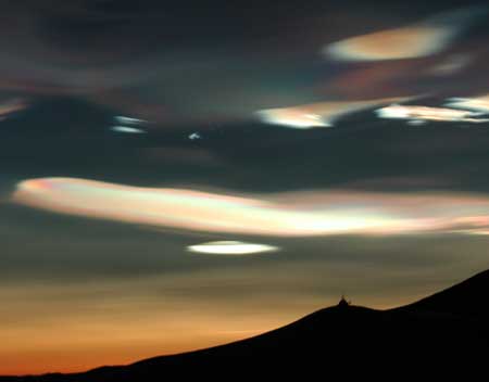
| 20:06, 28 August 2008 | NACREOUSCLOUDS3.JPG (file) |  |
8 KB | Photograph by: Dr. Bill Servais/D.D.S. McMurdo Hospital National Science Foundation Date Taken: September 2003 Nacreous clouds near McMurdo, Ross Island, Antarctica. These polar stratospheric clouds at 80,000 feet are the highest of all clouds. They onl | 1 |
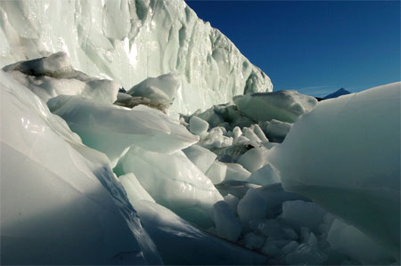
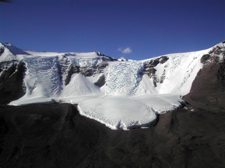
| 20:05, 28 August 2008 | ICEFALL2.JPG (file) |  |
31 KB | Photograph by: Joe Mastroianni National Science Foundation Date Taken: November 12, 2004 Canada Glacier icefall, Victoria Land, Antarctica. | 1 |
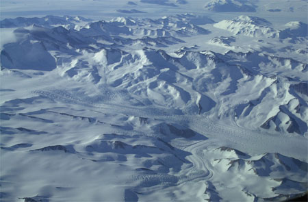
| 20:04, 28 August 2008 | GLACIERANDMOUNTAINS.JPG (file) |  |
40 KB | Photograph by: Emily Stone National Science Foundation Date Taken: December 6, 2004 The Transantarctic Mountains between McMurdo Station and Amundsen-Scott South Pole Station. The lines in the glaciers illustrate crevasses formed by the movement of the | 1 |
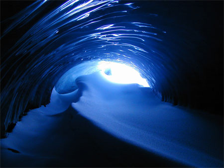
| 19:59, 28 August 2008 | BLUEICECAVE.JPG (file) |  |
35 KB | Photograph by: Zenobia Evans National Science Foundation Date Taken: July 24, 2000 An ice cave at Loudwater Cove on Anvers Island, near the Antarctic Peninsula. | 1 |
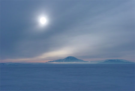
| 19:58, 28 August 2008 | SUNANDDISCOVERY.JPG (file) |  |
16 KB | Photograph by: Jaime Ramos National Science Foundation Date Taken: Austral summer 2004 - 2005 The sun cuts through thick clouds and casts an eerie glow on Mount Discovery in McMurdo Sound. | 1 |
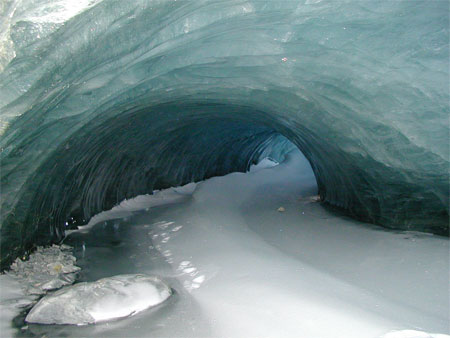
| 19:56, 28 August 2008 | PALMERICECAVE.JPG (file) |  |
35 KB | Photograph by: Zee Evans National Science Foundation Date Taken: July 24, 2000 An ice cave near Palmer Station, Anvers Island, Antarctica. | 1 |
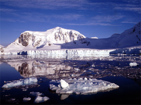
| 19:55, 28 August 2008 | GERLACHESTRAIT5.JPG (file) |  |
43 KB | Photograph by: Zee Evans National Science Foundation Date Taken: November 12, 20004 The Gerlache Strait between Anvers Island and the Antarctic Peninsula. | 1 |
| 19:48, 28 August 2008 | SPINERIDGE.JPG (file) |  |
24 KB | Photograph by: Andre Fleuette National Science Foundation Date Taken: November 6, 2005 Pressure ridges are formed by shifting sea ice colliding with stationary ice. | 1 |
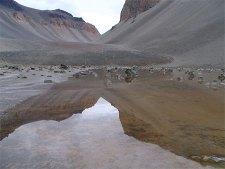
| 19:46, 28 August 2008 | DONJUAN.JPG (file) |  |
33 KB | Photograph by: Glen Snyder National Science Foundation Date Taken: December 8, 2005 The shallow saline Don Juan Pond is located in the Wright Valley, Victoria Land. A new mineral, calcium chloride hexahydrate (also known as Antarcticite) was discovered | 1 |
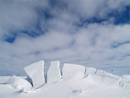
| 19:28, 28 August 2008 | Scenic 1000 coronation18.jpg (file) |  |
78 KB | Coronation Island, South Orkneys group 18 Use of picture courtesy Paul Ward - CoolAntarctica.com http://www.coolantarctica.com | 2 |
| 05:42, 28 August 2008 | CALKINGLACIER.JPG (file) |  |
63 KB | 2 |